Image World map 1689

Image World map 1689
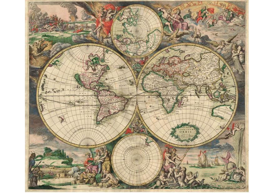
Clipart of a world map from 1689 showing four circles with different continents and decorative elements. Free to download and print.
Category: Image Maps > World map 1689
Keywords: World map 1689
Image informationPD 9 - World map - Produced in Amsterdam. First edition : 1689. Original size : 48.3 x 56.0 cm. Produced using copper engraving.
Author: van Schagen.
All images can be used for private, educational, non-commercial purposes.
For all other use, see the Image License and/or Terms of Use.
Please feel free to contact us for more information.
