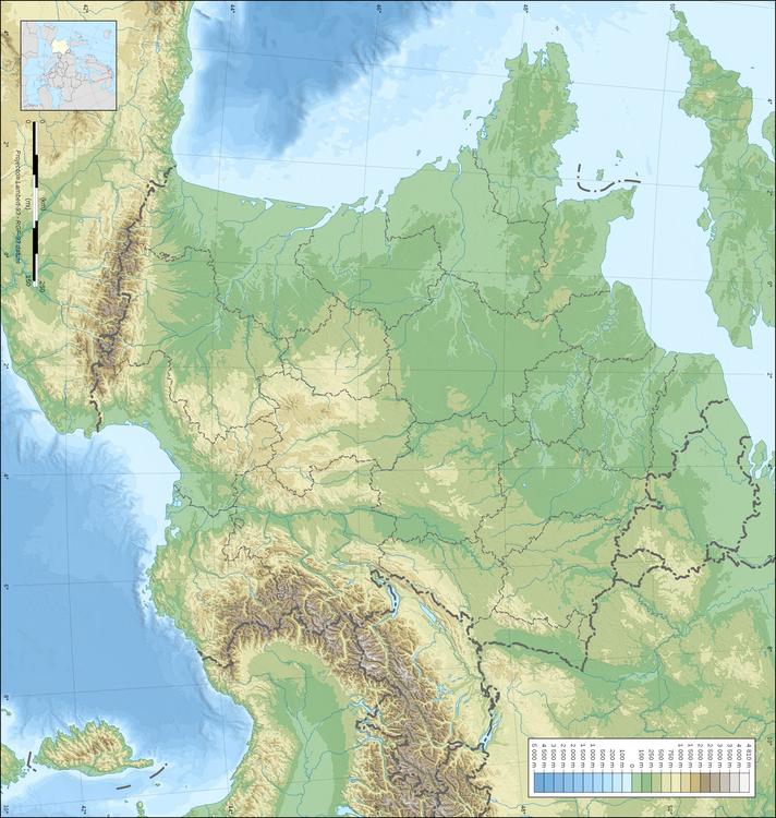
Category: Image Maps > Topography of France
Coloring page, drawing, picture, school, education, primary school, educational image: Topography of France
Keywords: Topography of France, landscapes, major features,
Image information
Attribution and Share-Alike required
Any use of this map can be made as long as you credit me (Eric Gaba – Wikimedia Commons user: Sting) as the author and distribute the copies and derivative works under the same license(s) that the one(s) stated below. A message with a reply address would also be greatly appreciated.
Sources of data:
Blank topographic map of France in the official Lambert-93 projection, with regions boundaries.