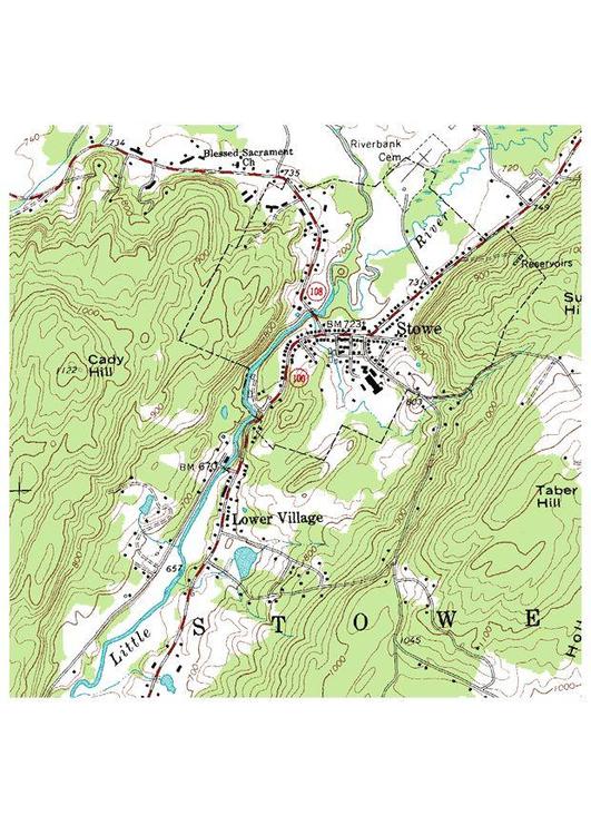
Africa
Category 'Maps'


Educational image:
survey map


Image survey map


forward

Image survey map
Image survey map [354x500]

forward


Rating:


Edit with ImageBot
- 620x875 = A4 -


Please use Forest Friendly paper for printing.

survey map - Images for schools and education - teaching resources
Category: Home > Image Geography > Image Maps > survey map
Coloring page, drawing, picture, school, education, primary school, educational image: survey map
 
--- Image information ---
PD 10 - Source: Sample taken from the public domain USGS Digital Raster Graphic file o44072d6.tif for the Stowe, VT quadrangle
Material originally came from the United States Geological Survey.


All images can be used for private educational, non-commercial purposes.
For all other use see Image License and/or Terms of Use.
Plz feel free to contact us for more information.

hotchalk
survey map