Category: Image Child labour > child labour map
Coloring page, drawing, picture, school, education, primary school, educational image: child labour map
Keywords: child labour map, child, labour, exploitation, clandestine, child welfare,
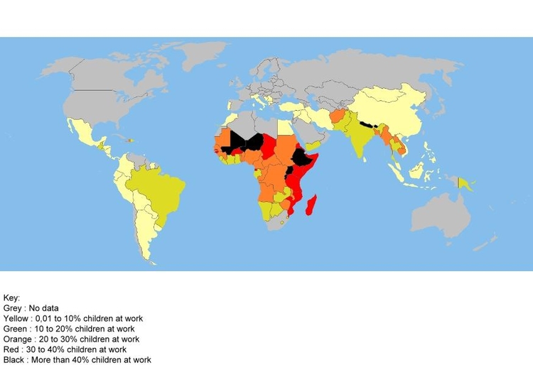
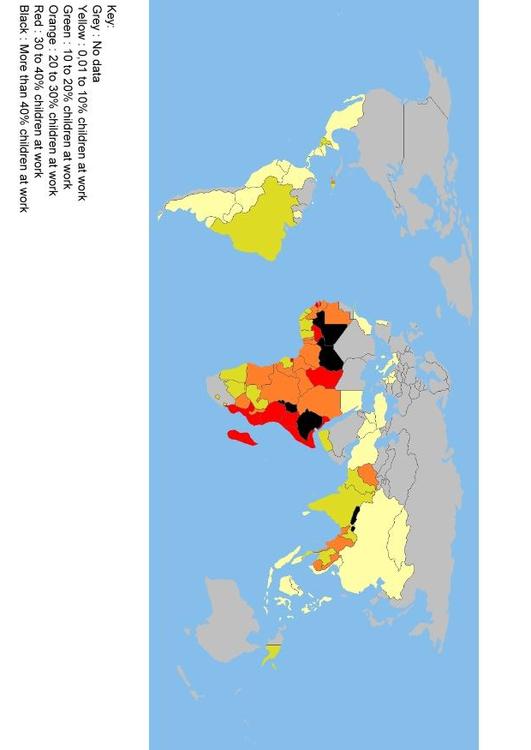
Image information<br>This file is licensed under the <a href="http://en.wikipedia.org/wiki/GNU_Free_Documentation_License" target="_blank"> GNU Free Documentation License </a> <br> Children at work world map : proportion of children aged 5 to 14 who are involved in a form of childwork. <br> Source World Bank World Development Indicators 2005 data series: Labour force, children 5-14 (% of age group, SL.TLF.CHLD.ZS) <br> Author: historicair (Wikipedia) 19:58, 5 December 2006 (UTC)