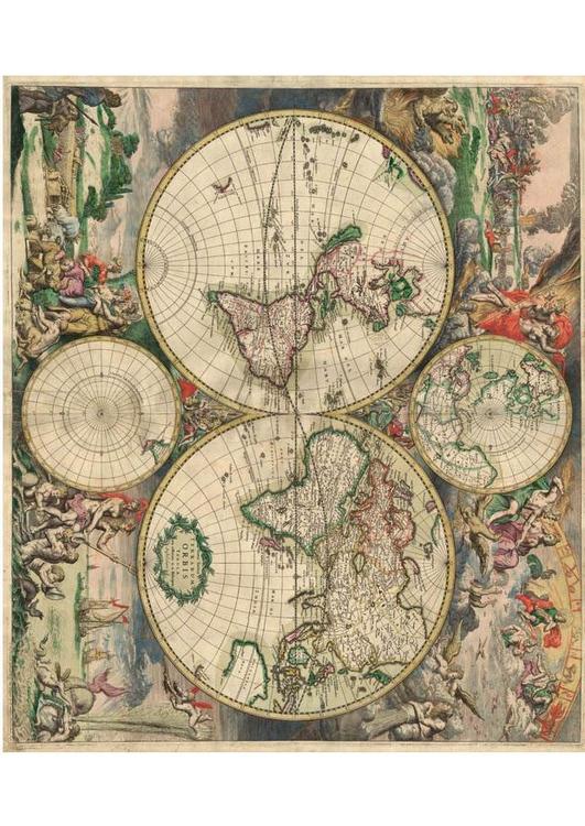
Africa
Category 'Earth'


Educational image:
World map 1689


Image World map 1689


forward

Image World map 1689
Image World map 1689 [500x354]


Rating:


Edit with ImageBot
- 620x875 = A4 -


Please use Forest Friendly paper for printing.

World map 1689 - Images for schools and education - teaching resources
Category: Home > Image Geography > Image Earth > World map 1689
Coloring page, drawing, picture, school, education, primary school, educational image: World map 1689
 
--- Image information ---
PD 9 - World map - Produced in Amsterdam. First edition : 1689. Original size : 48.3 x 56.0 cm. Produced using copper engraving.
Author: van Schagen.


All images can be used for private educational, non-commercial purposes.
For all other use see Image License and/or Terms of Use.
Plz feel free to contact us for more information.

hotchalk
World map 1689