map of Mayan civilization
Category 'Mayas'


Educational image:
map of Mayan civilization


Image map of Mayan civilization


Image map of Mayan civilization
Image map of Mayan civilization [500x354]


Rating:


Edit with ImageBot
- 620x875 = A4 -


Please use Forest Friendly paper for printing.

map of Mayan civilization - Images for schools and education - teaching resources
Category: Home > Image History > Image Precolombian cultures > Image Mayas > map of Mayan civilization
Coloring page, drawing, picture, school, education, primary school, educational image: map of Mayan civilization
 
--- Image information ---
This file is licensed under the GNU Free Documentation License - Author Yavidaxiu
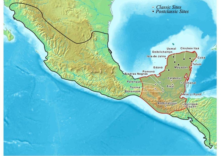
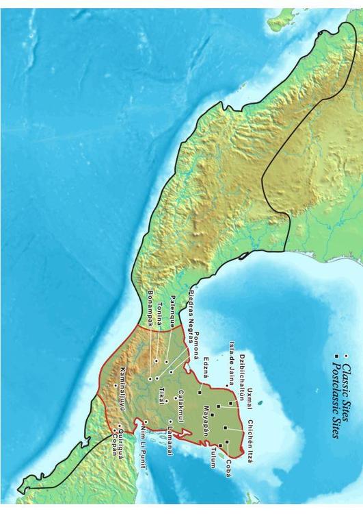
Map showing the extent of the Maya civilization. This map shows the cities and cultural mainsteads of the Maya, who did not have an empire but rather a group of loosely associated city-states.


All images can be used for private educational, non-commercial purposes.
For all other use see Image License and/or Terms of Use.
Plz feel free to contact us for more information.

hotchalk
map of Mayan civilization